

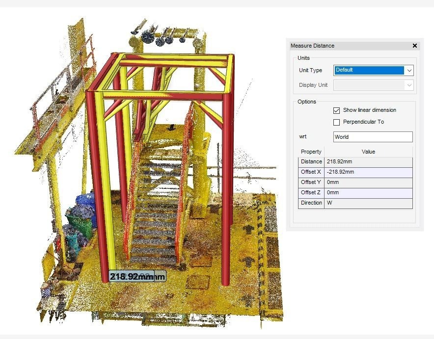
3D LASER SCANNING & DIMENSIONAL CONTROL SURVEY
3D Laser Scanning is an emerging technology which is revolutionising digital data capture for 3D usage. Across all industries, 3-dimensional environments have become the standard for design, presentation and engineering.

UTILITY DETECTION MAPPING
Utility detection mapping is a process that involves identifying and mapping the underground utilities within a specific area. This is crucial for various construction and engineering projects to prevent damage to existing utility lines and ensure safety.

TANK INSPECTION AND ASSESMENT
Tank inspection and assessment involve a comprehensive evaluation of the condition, integrity, and safety of storage tanks, which can store liquids or gases. The primary purpose of tank inspection and assessment is to ensure...
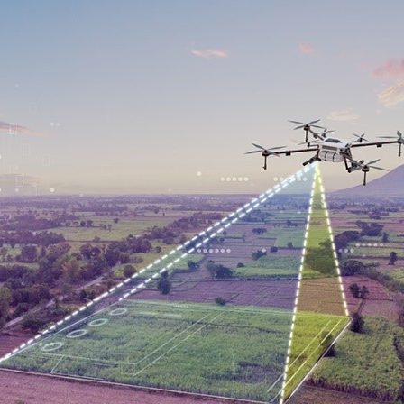
DRONE MAPPING
Drone mapping in engineering involves the use of unmanned aerial vehicles (drones) equipped with cameras or sensors to capture high-resolution imagery and topographic data of a site. This technology provides a cost-effective and efficient way to gather accurate geospatial information for engineering applications.

AS-BUILT 3D MODELLING
As-built 3D modeling is the process of creating a three-dimensional representation of a structure or environment based on the actual, real-world measurements and conditions. This modeling technique is commonly used in construction, architecture, engineering, and...
MINOR ENGINEERING
"Minor Engineering" typically refers to small-scale engineering projects, tasks, or modifications that are not as extensive or complex as major engineering endeavours. The scope of minor engineering projects may vary across industries, but they generally involve smaller-scale initiatives that can be completed relatively quickly and with fewer resources.
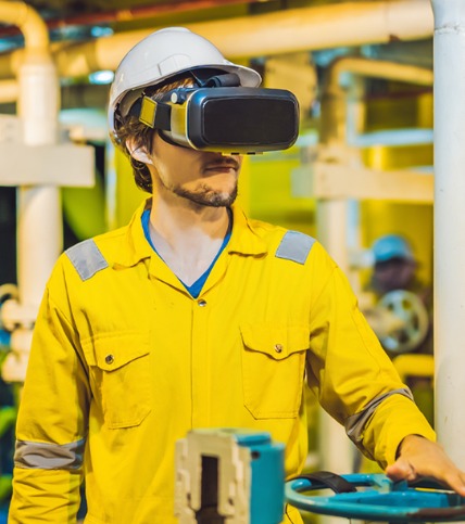
VIRTUAL REALITY / AUGEMENTED REALITY
Virtual Reality (VR) andAugmented Reality (AR) are immersive technologies that alter or enhance the way users perceive the real world. Virtual Reality (VR) creates a simulated, computer-generated environment that users can interact with, often using specialized hardware like VR headsets.